Map - Ziguinchor

Ziguinchor
Ziguinchor (Siggcoor ; زيغينكور) is the capital of the Ziguinchor Region, and the chief town of the Casamance area of Senegal, lying at the mouth of the Casamance River. It has a population of over 230,000 (2007 estimate). It is the seventh largest city of Senegal, but largely separated from the north of the country by The Gambia.

Unlike the semi-arid to arid north of Senegal, as it is under the influence of the West African Monsoon, Ziguinchor has a tropical savanna climate, with an average annual accumulated rainfall of approximately 1547 mm.

There are several competing etymologies for Ziguinchor's name. The most well-known comes from the time when Portuguese traders and explorers came to the region to form a trading post, and derives from Portuguese Cheguei e choram, "I came and they cry". The local people, seeing the Europeans, began crying, thinking they were about to be enslaved. The name, however, likely predates the Portuguese arrival, as the earliest sources mention the Bainuk of Ezigichor. The term may come from the Bainuk language words "asi nin core," meaning "places to go are finished," relating to the end of the Bainuk migrations in their traditional history. It could also come from "ji gi cor," meaning "place of several fields."

 
Map - Ziguinchor
Map
Google Earth - Map - Ziguinchor
Google Earth
Openstreetmap - Map - Ziguinchor
Openstreetmap
Map - Ziguinchor - Esri.WorldImagery
Esri.WorldImagery
Map - Ziguinchor - Esri.WorldStreetMap
Esri.WorldStreetMap
Map - Ziguinchor - OpenStreetMap.Mapnik
OpenStreetMap.Mapnik
Map - Ziguinchor - OpenStreetMap.HOT
OpenStreetMap.HOT
Map - Ziguinchor - OpenTopoMap
OpenTopoMap
Map - Ziguinchor - CartoDB.Positron
CartoDB.Positron
Map - Ziguinchor - CartoDB.Voyager
CartoDB.Voyager
Map - Ziguinchor - OpenMapSurfer.Roads
OpenMapSurfer.Roads
Map - Ziguinchor - Esri.WorldTopoMap
Esri.WorldTopoMap
Map - Ziguinchor - Stamen.TonerLite
Stamen.TonerLite
Country - Senegal
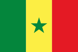
Flag of Senegal
Senegal, officially the Republic of Senegal, is a country in West Africa, on the Atlantic Ocean coastline. Senegal is bordered by Mauritania to the north, Mali to the east, Guinea to the southeast and Guinea-Bissau to the southwest. Senegal nearly surrounds the Gambia, a country occupying a narrow sliver of land along the banks of the Gambia River, which separates Senegal's southern region of Casamance from the rest of the country. Senegal also shares a maritime border with Cape Verde. Senegal's economic and political capital is Dakar.

Senegal is notably the westernmost country in the mainland of the Old World, or Afro-Eurasia. It owes its name to the Senegal River, which borders it to the east and north. The climate is typically Sahelian, though there is a rainy season. Senegal covers a land area of almost 197000 km2 and has a population of around million. The state is a unitary presidential republic; since the country's foundation in 1960, it has been recognized as one of the most stable countries on the African continent.
Currency / Language  
ISO Currency Symbol Significant figures
XOF West African CFA franc Fr 0
Neighbourhood - Country  
  •  Guinea 
  •  Guinea-Bissau 
  •  Mali 
  •  Mauritania 
  •  The Gambia